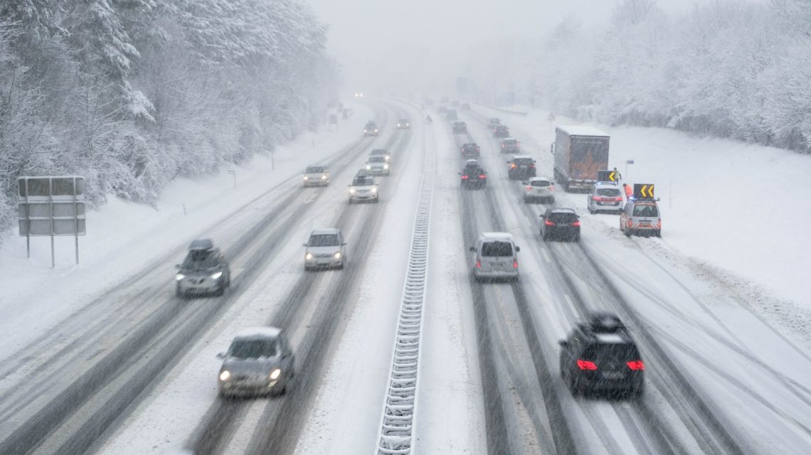
A late-season winter storm is set to deliver heavy snowfall to regions within Montana and Wyoming. Forecasters caution that certain mountainous areas could witness over a foot of accumulation by Thursday.
Impact of Snowfall
Although snow at high elevations during May is not rare, the timing and strength of this storm highlight the lingering winter conditions well into spring. Such heavy snowfall can disrupt travel in mountain regions seeing increased recreational activity, potentially impacting local economies and early outdoor activities. Additionally, the snow and changing temperatures may lead to unstable conditions in elevated terrains, raising concerns about avalanches or delayed runoff impacts later in the season.
Weather Warnings and Advisories
The National Weather Service (NWS) in Billings has announced a winter storm warning for parts of southern Montana. A winter weather advisory covers areas stretching across both states. Accumulations could reach up to 13 inches in certain areas, with strong winds that might decrease visibility and create hazardous situations.
Montana Winter Storm Warning
In effect from 6 p.m. Wednesday to 6 p.m. MDT Thursday for the Absaroka and Beartooth Mountains, including Cooke City.
Expected heavy snow mainly on north-facing slopes above 7,000 feet, with a total forecast of 8 to 13 inches. Winds could gust up to 30 mph.
High country recreation may face significant disruptions due to accumulating snow. Those exploring mountainous landscapes should carry emergency supplies, like extra food, water, and flashlights, in case conditions worsen. Weather insights from windy.com indicate the heaviest snowfall areas over the upcoming days.
Wyoming Winter Weather Advisory
Issued from 3 a.m. to 9 p.m. MDT Thursday for the Pryor/Northern Bighorn Mountains in Montana and the Northeast Bighorn Mountains in Wyoming, including areas near Burgess Junction and Story.
Snow accumulations of 5 to 10 inches anticipated, with winds possibly reaching 30 mph. Travel conditions throughout the day, especially during morning and evening, may become challenging.
Roads like U.S. Route 14 may become slippery and dangerous amid accumulating snow and rising winds. Drivers should decrease speed and remain vigilant, as officials warn of rapidly changing conditions. It is advisable to check road conditions before traveling and stay tuned for updated forecasts as the storm unfolds.
Thunderstorms and Rain
Lower elevations might experience thunderstorms and rain as a cold front moves through. Showers and weak thunderstorms could spread throughout the region this afternoon and evening. The storms might bring gusty, erratic winds, small hail, and brief downpours, according to NWS Billings.
Cold Weather Hits Great Lakes Region
NWS offices in the Great Lakes have issued frost advisories and freeze warnings amid the cold weather sweeping the region. These advisories involve northeast Minnesota, northern Wisconsin, and various parts of Michigan and the Upper Peninsula. Freeze warnings, which are more severe than frost advisories, have also been announced across Michigan. Temperature map animations from windy.com display the cold temperatures advancing through the area.
Steps for Residents and Visitors
As alerts continue until Thursday night, residents and visitors should take several measures:
- Stay informed: Regularly check local NWS updates and state DOT road reports before traveling.
- Adjust driving habits: Slow down significantly. Spring tires do not handle late-season mountain slush like winter tires.
- Pack the essentials: When venturing near the backcountry, ensure to carry waterproof layers, heavy thermal wear, and an emergency cold-weather kit.
 Lawsuits Against Federal Government Following Pennsylvania Rally Shooting
  New Jersey Struggles with Protests Near Immigration Detention Center
  Newark Scales Back Police Presence at Detention Center Protests
  Investigation into Bus Company’s Network and Safety Violations
  Inflation’s Rise Challenges Economists’ Claims
  Support Pours in for Airport Worker After Viral Video